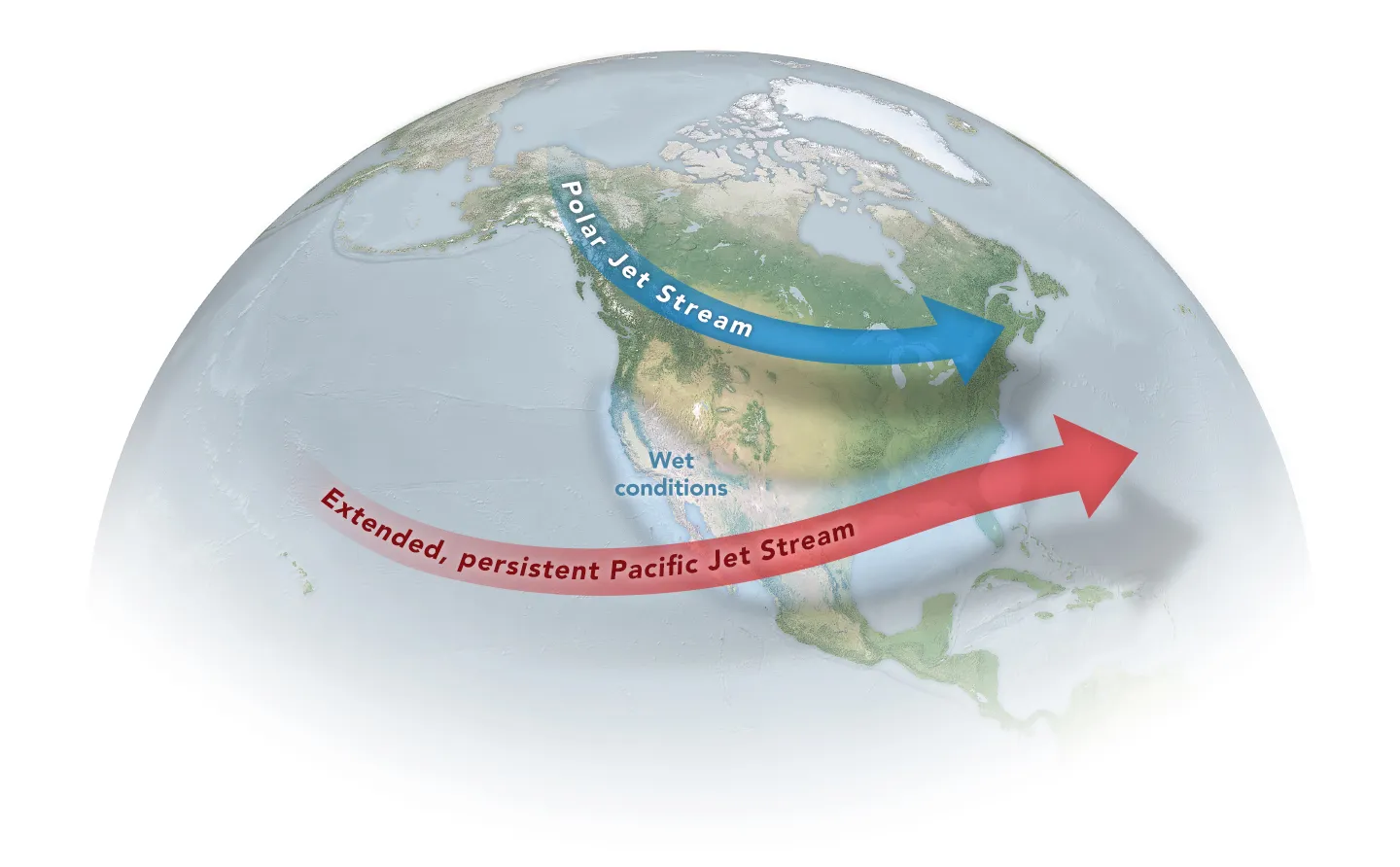
Something significant is happening thousands of miles from Southern California, along the equatorial Pacific Ocean.
El Niño is strengthening rapidly, and federal climate scientists now believe the developing 2026–27 event could become one of the strongest observed in the modern record.
For Southern Californians, that deserves attention—but not panic.
El Niño does not mean that Los Angeles will experience months of nonstop rain. It does not guarantee catastrophic flooding. It does not mean every storm will be severe, nor does it eliminate the possibility of hot, dry weather or wildfire.
What it does mean is that conditions in the Pacific Ocean are increasingly capable of influencing weather patterns across a vast portion of the globe. For Southern California, the possible consequences extend well beyond rainfall.
Heavy precipitation, flash flooding, debris flows, high surf, coastal erosion, dangerous ocean conditions, warmer temperatures, unusual humidity, infrastructure problems and changing wildfire conditions can all become part of the El Niño story.
That makes this an appropriate time to understand what is developing—and to begin preparing for what could follow.
This El Niño Has Scientists’ Attention
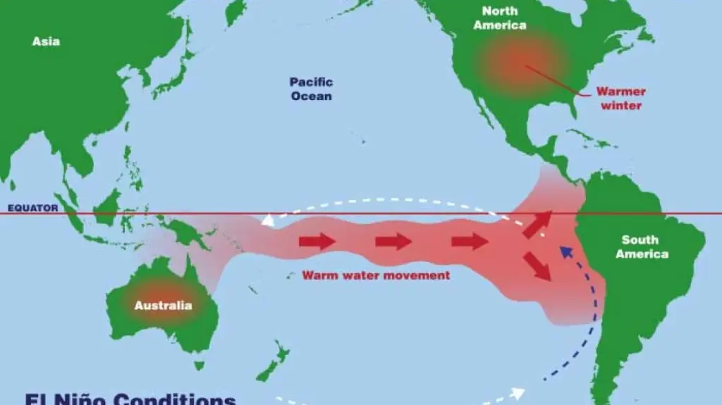
El Niño is the warm phase of a naturally occurring climate pattern known as the El Niño-Southern Oscillation, or ENSO. During an El Niño event, unusually warm surface water develops across portions of the central and eastern equatorial Pacific. Those changes interact with the atmosphere and can alter weather patterns far beyond the tropical Pacific.
El Niño conditions are already present in 2026.
In its August 13 update, the National Oceanic and Atmospheric Administration’s Climate Prediction Center reported that El Niño had strengthened during the previous month. Sea-surface temperature anomalies exceeded 2 degrees Celsius in portions of the eastern equatorial Pacific, while other oceanic and atmospheric indicators demonstrated that the ocean and atmosphere were increasingly working together as a coupled El Niño system.
NOAA now says there is a greater than 90 percent chance that El Niño will become “very strong” during the Northern Hemisphere fall and winter of 2026–27.
More remarkably, NOAA currently estimates a 69 percent probability that during the October-through-December period, the event could reach a level exceeding previous El Niño events in the agency’s record dating to 1950.
That is an extraordinary forecast.
It is not, however, an extraordinary-weather guarantee.
A Strong El Niño Is Not a Southern California Weather Forecast
This distinction is important.
Scientists measure the strength of El Niño primarily by examining ocean and atmospheric conditions across specific regions of the tropical Pacific. Those measurements tell scientists something about the state of the global climate system.
They cannot tell us in August exactly how much rain will fall in Los Angeles in January, where individual storms will travel, how large the waves will become at a particular beach, or whether a specific neighborhood will flood.
Even NOAA cautions that the strongest El Niño events do not produce the expected effects everywhere.
Southern California has experienced this firsthand.
The powerful 1997–98 El Niño contributed to a memorable winter of storms, flooding, coastal damage and other impacts in California. The very strong 2015–16 El Niño, by contrast, did not produce the Southern California rainfall that many people had anticipated.
That history gives us an important lesson for 2026:
El Niño changes the odds. It does not dictate the outcome.
Preparing for elevated risk is therefore very different from predicting disaster.
Rain Will Get the Attention—but Intensity May Matter More Than Totals
For many Southern Californians, El Niño means one thing: rain.
There is good reason for the association. Strong El Niño conditions can influence Pacific storm patterns in ways that increase the likelihood of wetter conditions in parts of California.
But annual rainfall totals alone do not determine whether a winter becomes dangerous.
How rain falls can be just as important as how much falls.
A substantial amount of precipitation spread across many weeks may be manageable and beneficial. Several inches falling rapidly onto one watershed, neighborhood or burn area can create an entirely different situation.
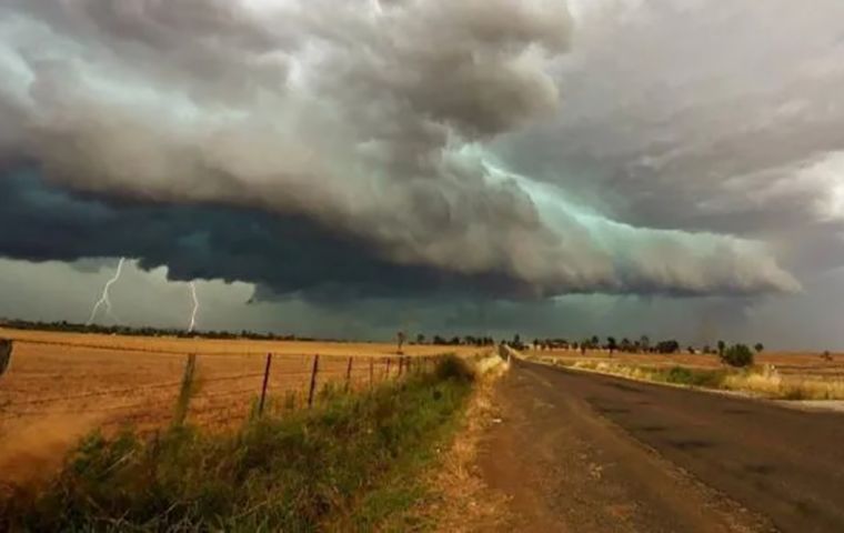
Intense rainfall can overwhelm storm drains and drainage channels, flood streets and underpasses, send water across freeways and canyon roads, topple trees and contribute to slope failures.
Atmospheric rivers can further complicate the picture. These long corridors of concentrated atmospheric moisture are responsible for a significant portion of California’s precipitation and can produce extremely heavy rainfall when conditions align.
El Niño does not guarantee atmospheric rivers will strike Southern California, nor is El Niño required for them to occur. But during any potentially active winter, residents should become accustomed to paying attention not simply to whether rain is forecast, but to how much, how quickly and where.
After Wildfire, Rain Can Become Another Hazard
Southern California’s recent wildfire history adds another dimension to the coming winter.
Wildfire dramatically changes a landscape. Vegetation that helped intercept rainfall may be gone. Soil characteristics can change. Slopes that previously absorbed or slowed runoff can respond differently when intense rainfall arrives.
That can create conditions for rapid runoff, erosion, rockfall and debris flows.
These hazards can develop quickly and can occur some distance downstream from the area that actually burned.
For communities near recent burn scars, a winter storm is therefore not simply a question of getting wet.
Residents may receive evacuation warnings or orders because of rainfall expected over a burned watershed—even while conditions at their individual homes appear relatively calm.
Those warnings should be taken seriously.
The wildfire may be over, but the effects of the fire on the landscape can continue through multiple rainy seasons.
MySafe:LA will examine the relationship between El Niño and Southern California wildfire risk in greater detail in a separate report.
Along the Coast, Watch the Ocean
Rain isn’t the only concern.
Some of the most dramatic impacts associated with past strong El Niño winters have occurred along California’s coastline.
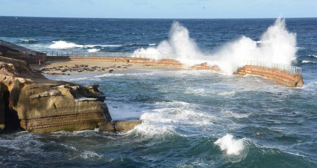
Powerful Pacific storms can generate large swells that travel considerable distances before reaching Southern California. When significant wave energy combines with high tides and elevated water levels, the result can include high surf, coastal flooding and substantial beach erosion.
During the 1997–98 El Niño, California experienced extensive coastal erosion and storm-related damage. Beaches changed shape, bluffs and coastal areas were affected, and powerful waves battered portions of the coast.
Similar concerns would be relevant during the coming winter if Pacific storms develop in locations capable of sending significant swell toward Southern California.
The danger isn’t limited to waterfront property.
Large surf attracts spectators.
That can put people on beaches, rocks, jetties and coastal structures precisely when those locations are most dangerous. A wave considerably larger than the ones preceding it can knock someone from rocks or sweep a person from what appeared to be a safe location.
Rip currents may also become particularly dangerous during periods of elevated surf.
When the National Weather Service issues a High Surf Advisory, High Surf Warning, Coastal Flood Advisory or related alert, it isn’t an invitation to get a closer look.
It is a warning about a potentially dangerous ocean.
Erosion May Continue Long After a Storm Ends
Coastal erosion deserves separate attention because its effects aren’t always obvious during the storm itself.
Repeated high-energy wave events can remove enormous quantities of sand, alter beaches and undercut coastal features. Bluffs can become unstable as waves attack them from below while rainfall saturates soils from above.
A cliff or bluff that survived a storm may therefore remain unstable afterward.
The same principle applies inland. Saturated slopes can fail after the heaviest rain has ended.
Southern Californians should resist assuming that the danger ends when the sun returns.
El Niño Doesn’t Necessarily Mean Cool Weather
Another common misconception is that a wet El Niño winter must also be a cold one.
Climate doesn’t work that simply.
Ocean temperatures, atmospheric circulation and individual weather systems interact in complicated ways. Southern California could still experience periods of unusually warm weather during an El Niño year.
Humidity may also become noticeable.
Warm ocean conditions and particular atmospheric patterns can produce periods when Southern California feels considerably more humid than residents accustomed to the region’s typically dry climate expect.
That isn’t merely uncomfortable.
Heat becomes harder for the human body to manage as humidity increases because perspiration evaporates less efficiently. Warm overnight temperatures can be particularly important because they reduce the opportunity for the body—and buildings without effective cooling—to recover from daytime heat.
Older adults, young children, outdoor workers and people with certain medical vulnerabilities can be especially affected by periods of heat and humidity.
El Niño therefore shouldn’t be viewed exclusively as a winter rain phenomenon. Its influence on the broader weather pattern can be relevant well before the traditional rainy season reaches its peak.
Our Infrastructure Will Be Tested, Too
Most people will never experience a dramatic debris flow or watch waves crash over a coastal structure.
They may experience El Niño in more ordinary—and disruptive—ways.
A storm drain clogged with debris.
A tree falling across a neighborhood street.
A flooded intersection.
A power outage.
A canyon road closed by rocks or mud.
A traffic signal without power.
A damaged utility line.
A freeway commute transformed by standing water and crashes.
Southern California is a highly developed region where millions of people depend upon interconnected transportation, power, communications, water and public-safety systems.
Severe weather can create cascading problems across those systems.
This is one reason personal preparedness matters. Emergency preparedness isn’t only about surviving a major earthquake or evacuating from a wildfire. It is also about being capable of functioning when everyday systems temporarily stop working as expected.
Don’t Drive Through Floodwater
There is one winter-weather message worth repeating now and throughout the coming rainy season:
Never drive through a flooded roadway when you cannot confidently determine its depth and condition.
Water can conceal damaged pavement, debris or a washed-out roadway. Moving water can also exert tremendous force against a vehicle.
Southern California drivers aren’t accustomed to frequent flooding, and familiarity with a particular street can create false confidence.
The road you drove yesterday may not be the same road beneath floodwater today.
Turn around and find another route.
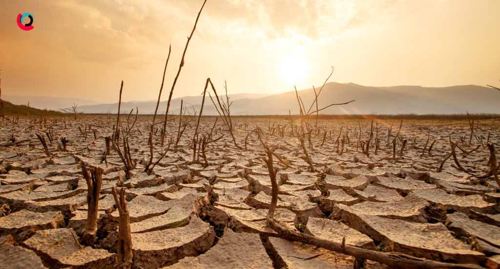
El Niño Doesn’t Cancel Wildfire Season
This may seem counterintuitive, particularly if Southern California experiences significant rainfall.
A strong El Niño does not mean wildfire risk disappears.
Santa Ana winds can still occur. Extended dry periods can still occur. Fuels can still become receptive to fire. Ignitions can still happen.
There is also a longer-term issue.
Abundant rainfall can stimulate vegetation growth. Grasses and other fine fuels that flourish during a wet period eventually dry. Depending upon subsequent weather, that vegetation can contribute to future fire behavior.
The relationship between El Niño and wildfire is complex enough that it deserves its own discussion. MySafe:LA and WildfireLA will be examining what the developing 2026–27 El Niño could mean for Southern California’s wildfire environment separately.
For now, the important message is simple:
Don’t stop preparing for wildfire because rain is coming.
Think in Seasons, Not Just Storms
Perhaps the most useful way to prepare for the developing El Niño is to stop thinking about it as a single weather event.
El Niño isn’t a storm.
There will not be an “El Niño storm” arriving on a particular Tuesday.
Instead, El Niño changes the background conditions within which individual weather systems develop and move.
For Southern California, the consequences could unfold over many months.
Late summer and fall may bring unusual heat or humidity.
Santa Ana winds and wildfire risk can remain important.
Winter may bring significant storms, flooding, high surf or debris-flow concerns.
Repeated rainfall can saturate soils and destabilize slopes.
Spring could bring unusually vigorous vegetation growth.
Later, that vegetation will dry.
Preparedness therefore needs to follow the same cycle.
What You Can Do Before the Rain Arrives
There are plenty of practical things Southern Californians can do without knowing exactly what the winter will bring.
Inspect your roof and gutters before the rainy season. Remove leaves and debris from gutters and drainage systems. Look at how water moves around your home and make certain drainage paths haven’t become obstructed.
Check trees for dead, damaged or unstable limbs.
If your property is adjacent to a slope, drainage channel or recently burned area, understand the hazards specific to your location.
Know whether you have flood insurance and understand what your homeowners or renters insurance does—and does not—cover.
Make certain you receive emergency alerts from your local jurisdiction.
Maintain emergency supplies, medications, flashlights and backup power for essential devices.
Keep your vehicle fueled or charged when significant storms are forecast.
If officials tell you to evacuate because of flooding or debris-flow potential, don’t wait until you can personally see the hazard.
And if you live near the coast, respect closures and warnings associated with high surf.
These are relatively simple actions, but preparedness frequently consists of simple actions taken before they become urgent.
Don’t Prepare for a Prediction. Prepare for the Possibilities.
There will undoubtedly be dramatic headlines about El Niño during the months ahead.
Some will call it historic.
Some may call it a “super El Niño.”
Some will inevitably attempt to predict exactly what Southern California’s winter will look like.
We should be more careful.
What scientists can tell us today is already significant: El Niño is strengthening rapidly, and current forecasts indicate a very high probability that it will become an exceptionally strong event.
What scientists cannot tell us yet is precisely how those conditions will translate into weather over Los Angeles, Orange, Riverside, San Bernardino, Ventura or San Diego counties on any particular day.
That uncertainty isn’t a reason to ignore the forecast.
It’s a reason to prepare intelligently.
Southern California has experienced floods, debris flows, coastal erosion, destructive surf, heat, wildfire and infrastructure failures before. We understand these hazards. We understand many of the actions that reduce their consequences.
We don’t need to know exactly what this El Niño will bring to begin taking those actions.
At MySafe:LA, our message throughout the coming months will remain straightforward:
Know your hazards. Follow reliable weather information. Pay attention to emergency warnings. Prepare your home. Prepare your family. And be ready to adapt as conditions change.
The Pacific is giving us advance notice that something potentially significant is developing.
What Southern California does with that notice is up to us.